
GIS Case Study
River Flood Early Warning System
A flood early-warning platform for a provincial disaster management agency monitoring a river basin in near real time.
Domain
Flood Early Warning / Disaster Management
Role
Full-Stack GIS Developer
At A Glance
What Makes It Work
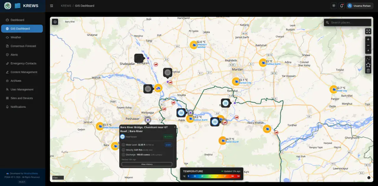
Flood sensors reporting live water level, velocity and discharge with status flags
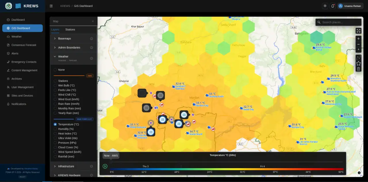
Automatic weather stations feeding nowcast-to-forecast weather surfaces
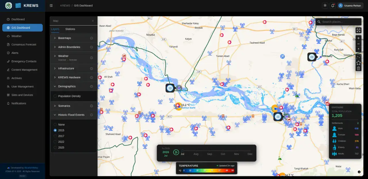
Historic flood extents for 2015, 2017, 2022 and 2025 with month-by-month playback
Population exposure analysis across settlements and critical infrastructure
Capabilities
Core Functionality
Flood sensor pop-ups showing water level, velocity, discharge, status and full history
Weather layer switcher spanning nowcast and forecast products
Hexbin temperature and rainfall surfaces driven by a 24-hour animated timeline
Historic flood extent layers selectable by year with monthly playback
Exposure panel breaking down total population, settlements, male, female, children, elderly and adults
Infrastructure and hardware layers — towers, health facilities and schools
Alerts, emergency contacts, archives, notifications and site / device management
Technologies
Tools & Stack
Product
From The Working Application
Portfolio
Explore More GIS Projects
Contact Us
Have A Project?
Let’s Build ItHave a project in mind? Tell us what you're building and we'll get back to you within 12–24 hours with a clear plan.
🔒
100% Confidential
⚡
12–24 Hr Response
🛡️
60-Day Bug Fix
✅
Free Consultation
💬
Start Your Project
Fill in the details below or book a call