
GIS Case Study
River Basin Hydrological Monitor — Automated River Monitoring
A hydrological monitoring system that finds, downloads, processes and visualises river basin data on an automated schedule.
Domain
Hydrology / River Basin Monitoring
Role
Full-Stack GIS Developer
At A Glance
What Makes It Work
Near-real-time water level and discharge for river basin stations
Automated product discovery and download driven by cron jobs
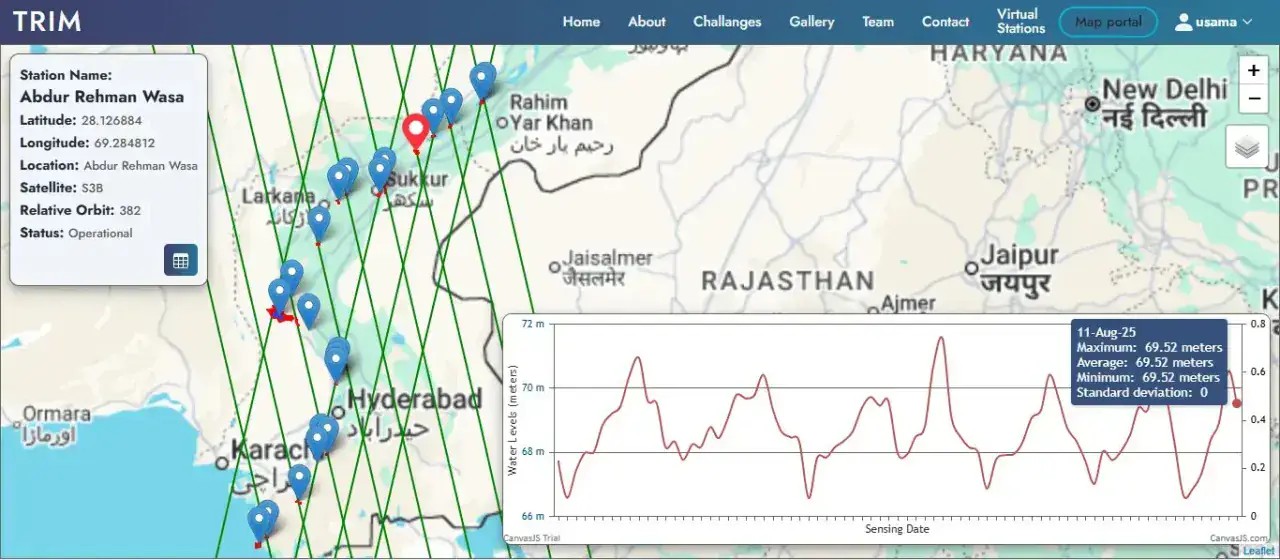
Station hydrographs plotted directly in the map pop-up
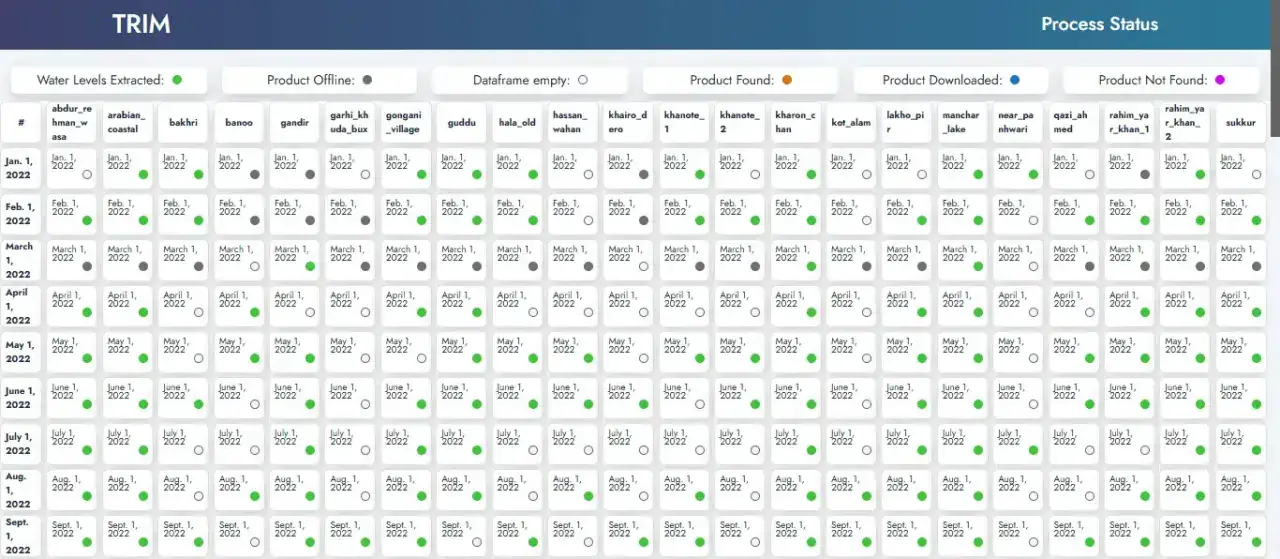
Processing status matrix showing exactly what was generated or missed
Capabilities
Core Functionality
Gauge-station layer across the river basin with location metadata
Pop-up hydrograph showing the recent water-level time series
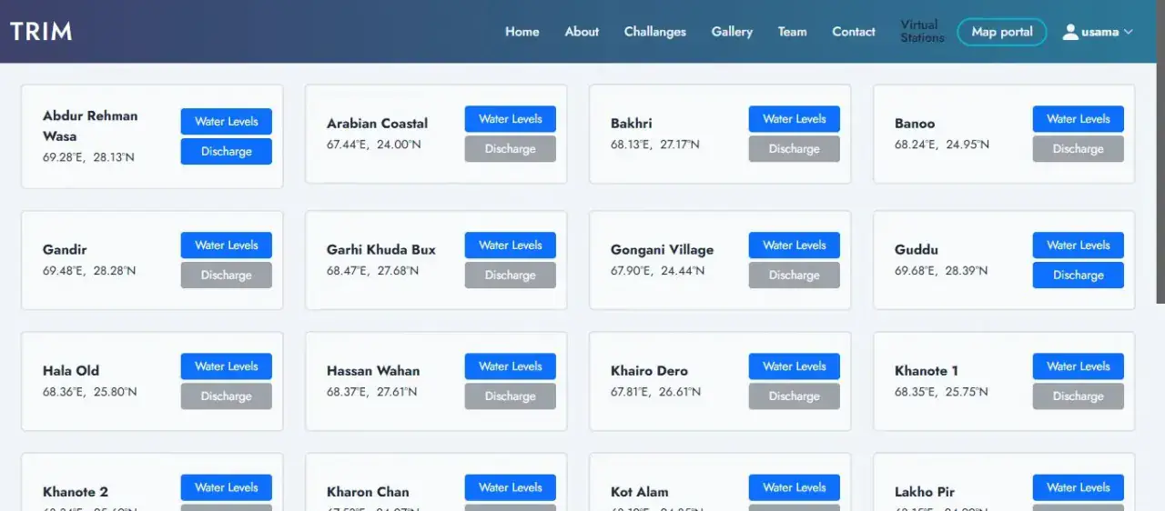
Station cards with direct links to water level and discharge views
Processing status matrix — generated, downloaded, found, not found, offline
Scheduled ingestion pipeline with retry and failure reporting
User accounts with sign-up, sign-in and password recovery
Station metadata: latitude, longitude, sensor, elevation and datum
Technologies
Tools & Stack
Product
From The Working Application
Portfolio
Explore More GIS Projects
Contact Us
Have A Project?
Let’s Build ItHave a project in mind? Tell us what you're building and we'll get back to you within 12–24 hours with a clear plan.
🔒
100% Confidential
⚡
12–24 Hr Response
🛡️
60-Day Bug Fix
✅
Free Consultation
💬
Start Your Project
Fill in the details below or book a call