GIS Case Study
Mining Licence Cadastre App — Mobile Application
A cross-platform mobile cadastre for a Mines & Minerals department, covering applications, concessions, clients and a map portal.
Domain
Mining / Natural Resource Governance
Role
Mobile & Backend Developer
At A Glance
What Makes It Work
Large-scale and small-scale mining applications tracked end to end
Dashboards for application counts, active concessions and revenue
Map portal showing licence areas, buffers and geology layers
Client register linked to every application and concession
A cadastre that fits in a pocket
A Mines and Minerals department managed licensing through paper files, a desktop register and a wall map. Large-scale and small-scale mining applications moved through approval stages that nobody could see at a glance; concession boundaries, buffers and geology lived on the wall; and the question of whether a new application overlapped an existing concession was answered by someone walking over to check. Field officers visiting a site had nothing with them but a printout. The department asked for a cross-platform mobile cadastre: the register, the workflow and the map, on a phone, for officers in the office and in the field.
Register, workflow and map in one application
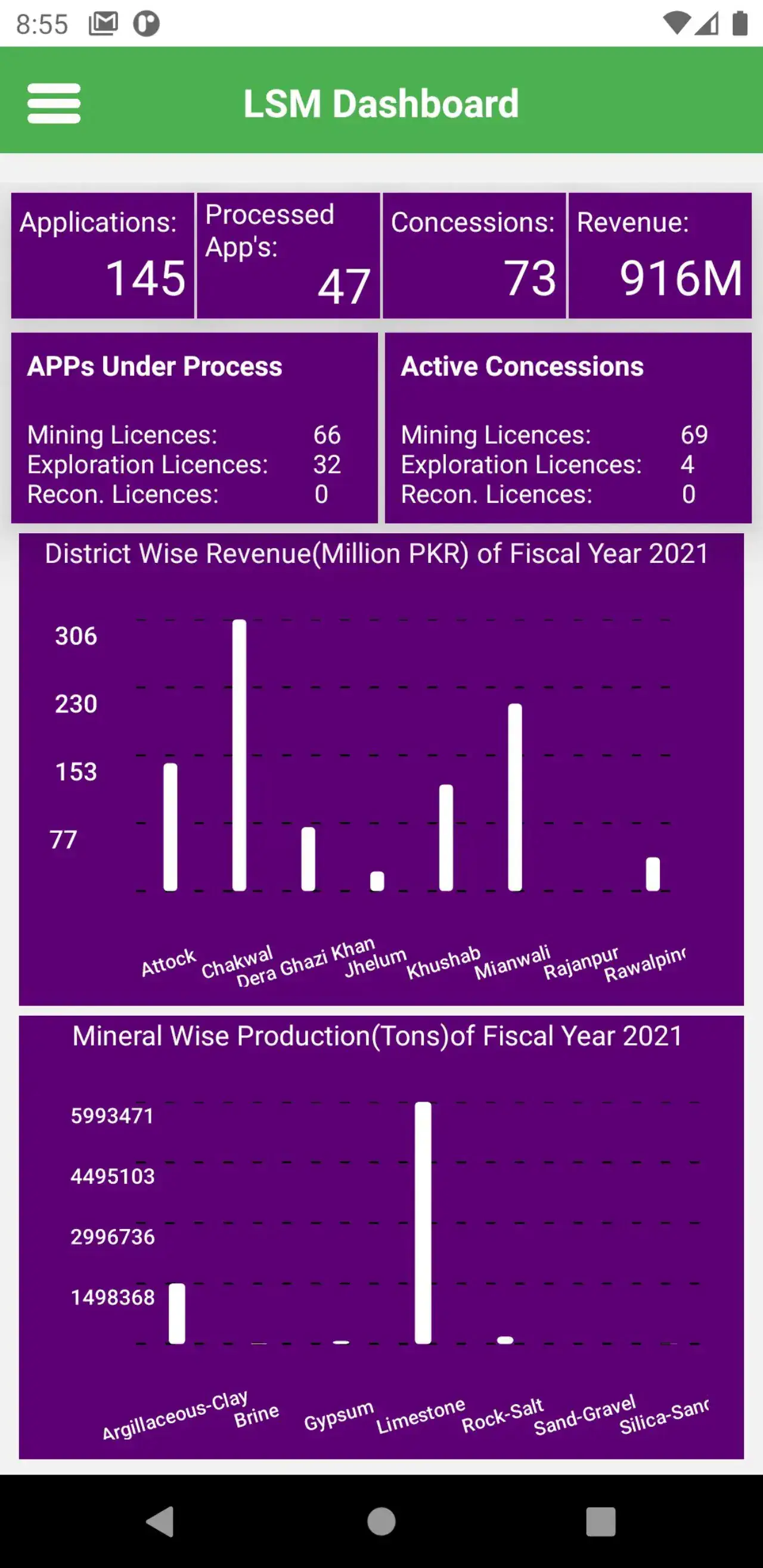
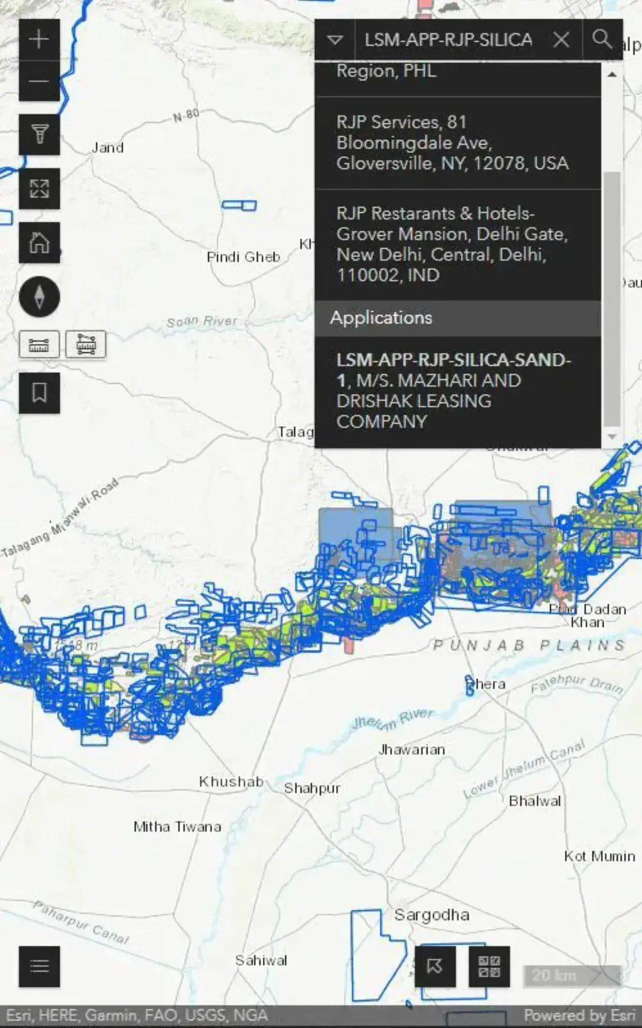
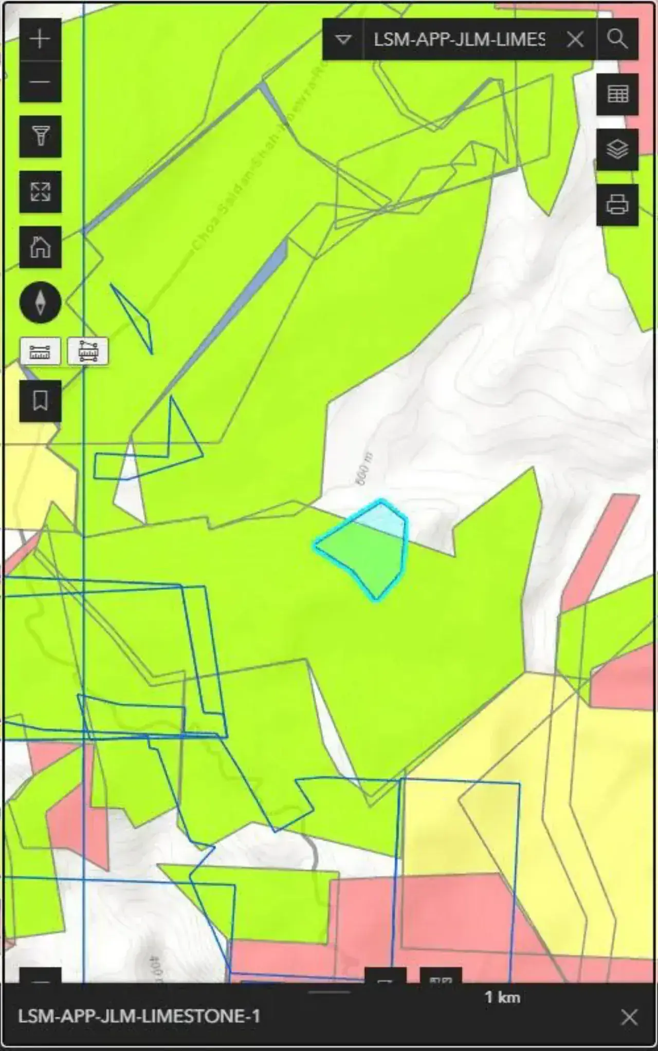
The app is built in React Native with Mapbox for the map portal and a Django back end holding the register. Large-scale and small-scale mining are handled as separate streams with their own dashboards: application counts, active concessions, revenue, and mineral-wise production charts by fiscal year. Application lists are colour-coded by status, under process, approved, rejected, expired, so an officer sees the state of the pipeline without opening a record. The application detail view draws the licence area on the map alongside concession boundaries, buffers and geology layers, which is the overlap check that used to require the wall. The concession register tracks expiry, litigation and vacancy, and a client register links every application and concession to the company or individual behind it. Because it is the same register on every device, an officer at a site sees exactly what the office sees.
From wall map to working tool
The department now runs licensing from the app. Overlap questions are answered on the map at the moment an application is filed. Expiring concessions surface before they lapse. Field officers carry the register with them and record what they find against the right record. The design principle was that a cadastre is a legal record first and a map second, so the register and workflow were built to be authoritative and the map portal reads from them, not the other way round. That ordering is what we bring to mobile app development for government departments where the app is a system of record rather than a convenience.
Capabilities
Core Functionality
LSM and SSM dashboards with application, concession and revenue totals
Mineral-wise production charts by fiscal year
Application lists colour-coded by status: under process, filed, offered, granted, rejected, withdrawn, deferred, converted, surrendered
Application detail view with the licence area drawn on the map
Concession register with expiry, litigation and vacancy status
Client directory with contact and CNIC records
Minerals catalogue with royalty rates
Map portal with concession polygons, buffers and geological overlays
Technologies
Tools & Stack
Product
From The Working Application
Questions
Frequently Asked Questions
Does the app work in the field without connectivity?
The register and map cache for offline viewing so an officer at a remote site can look up a concession and its boundaries. Edits made offline queue and sync when connectivity returns. Full offline operation was scoped for the field-officer role rather than the whole application.
How does it check whether a new application overlaps an existing concession?
The application's licence area is drawn on the map portal alongside all existing concession boundaries, buffers and geology layers. Overlap is visible immediately, and a spatial check against the register flags intersections when the application is filed.
Are large-scale and small-scale mining handled differently?
Yes. They run as separate streams with their own dashboards, application lists and reporting, because the approval workflows, fees and reporting requirements differ. The client register and map portal are shared across both.
Can we run this on both iOS and Android?
Yes. It is built in React Native from a single codebase and ships to both platforms. The department's officers use a mix of devices and the app behaves identically on each.
Contact Us
Have A Project?
Let’s Build ItHave a project in mind? Tell us what you're building and we'll get back to you within 12–24 hours with a clear plan.
🔒
100% Confidential
⚡
12–24 Hr Response
🛡️
60-Day Bug Fix
✅
Free Consultation
💬
Start Your Project
Fill in the details below or book a call