
GIS Case Study
Field Survey Capture App
A lightweight Flutter field-survey application for capturing, editing and reviewing georeferenced survey points offline and on.
Domain
Field Data Collection / Survey
Role
Mobile Developer
At A Glance
What Makes It Work
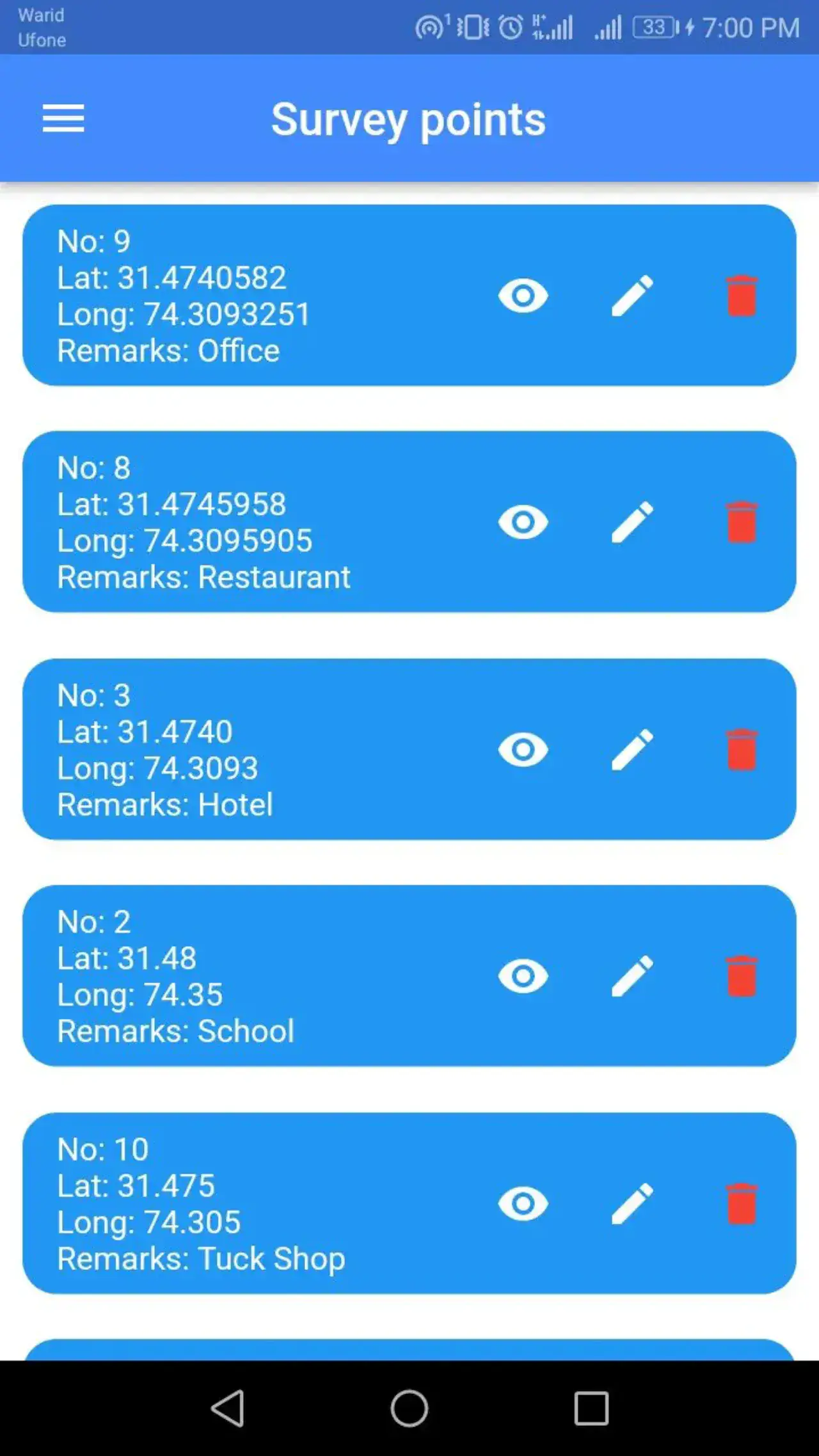
Survey points captured from the device GPS or entered by coordinate
Free-text remarks recorded against every captured point
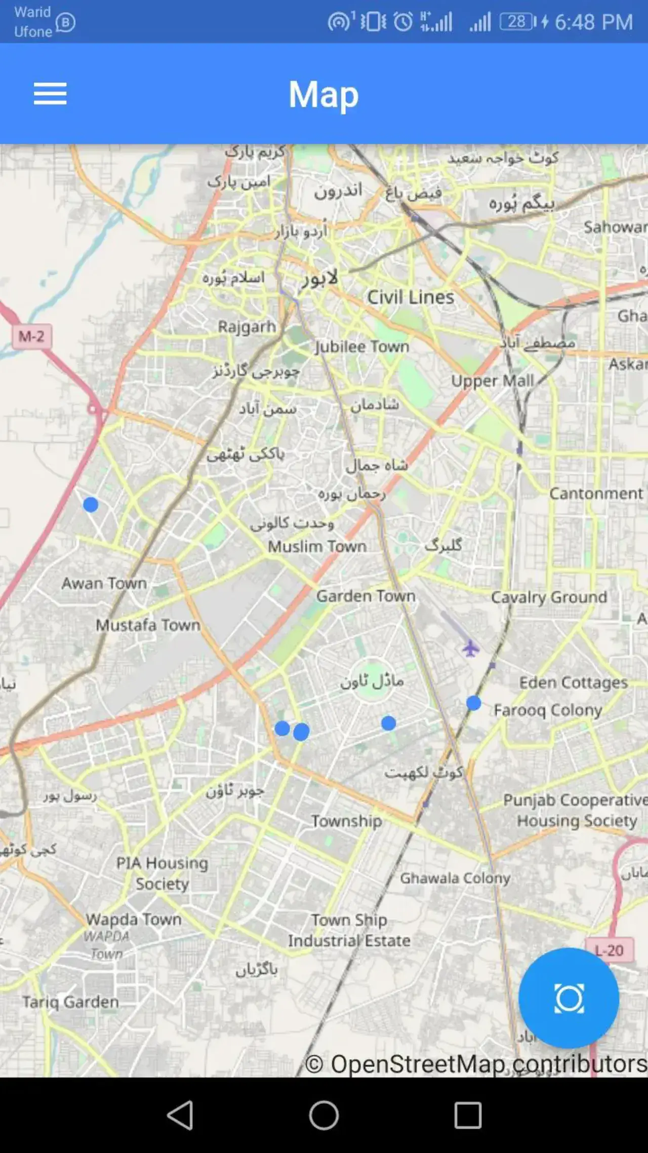
All collected points plotted on an OpenStreetMap base layer
Firebase-backed accounts so a surveyor's points follow them across devices
Capabilities
Core Functionality
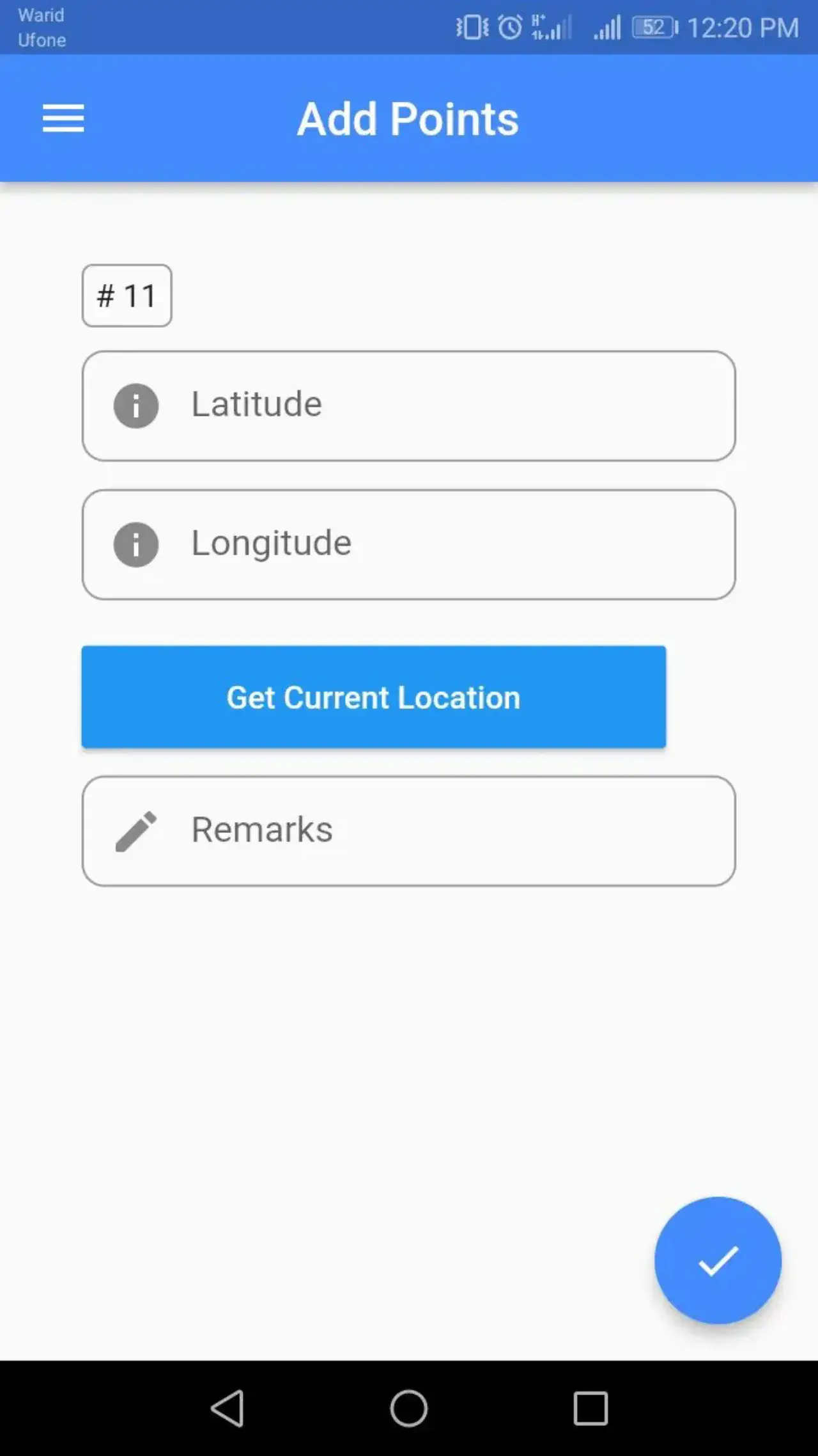
Add point with one-tap 'get current location' capture
Manual latitude / longitude entry for planned survey targets
Remarks field stored alongside each point record
Survey point list with view, edit and delete actions
Map view rendering every captured point as a marker
Zoom to a saved point directly from the list
Email sign-up, sign-in and password reset via Firebase Auth
Technologies
Tools & Stack
Product
From The Working Application
Portfolio
Explore More GIS Projects
Contact Us
Have A Project?
Let’s Build ItHave a project in mind? Tell us what you're building and we'll get back to you within 12–24 hours with a clear plan.
🔒
100% Confidential
⚡
12–24 Hr Response
🛡️
60-Day Bug Fix
✅
Free Consultation
💬
Start Your Project
Fill in the details below or book a call