
GIS Case Study
National Disaster Anticipation Platform — V5
The current release (V5) of a national anticipatory disaster-management platform, rebuilt around a dark operations theme and a global data catalogue.
Domain
Disaster Management / National Emergency Response
Role
Full-Stack GIS Developer
At A Glance
What Makes It Work
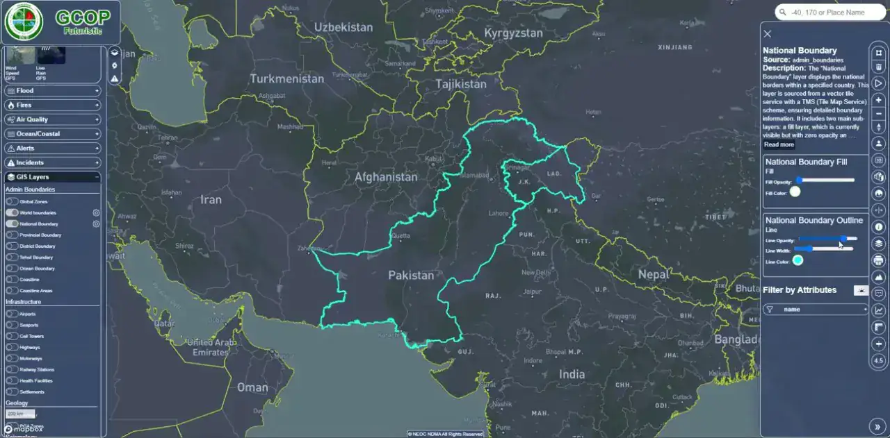
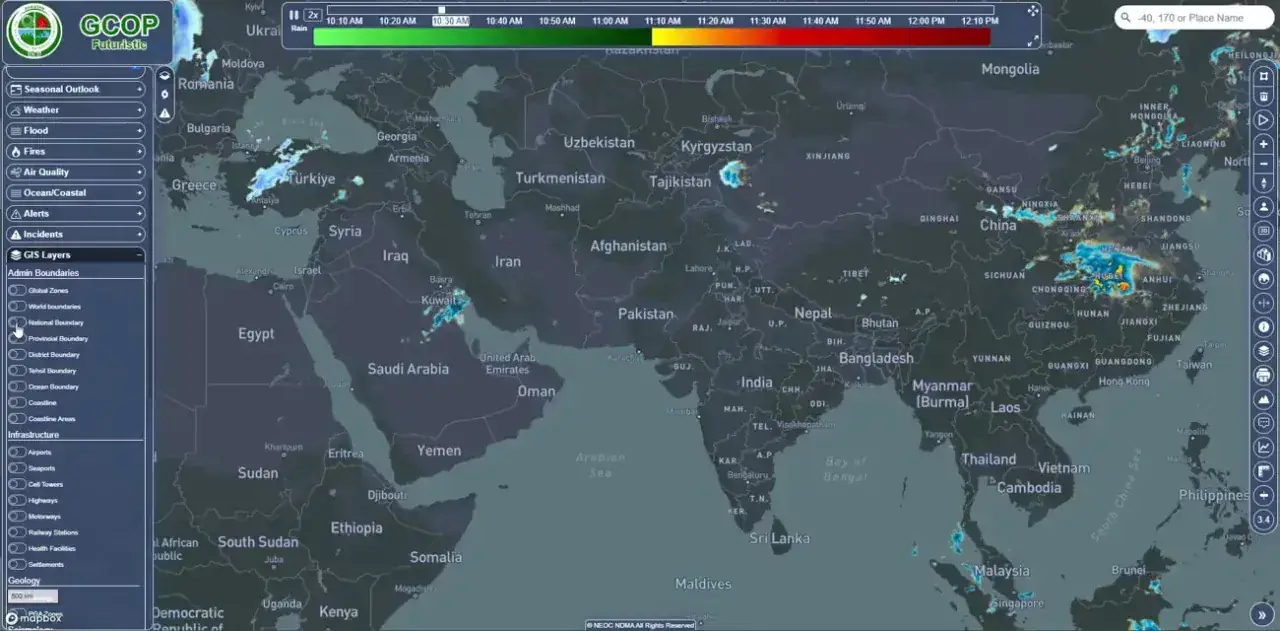
Global hazard coverage with a redesigned dark operations-room interface
Administrative boundary intelligence with full attribute inspection
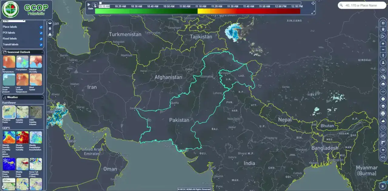
Time-series legend and playback across near-real-time hazard rasters
Live feeds from USGS Earthquake API, GLOFAS, EUMETSAT, GDACS and Global Water Watch
Capabilities
Core Functionality
Redesigned dark map theme tuned for 24/7 control-room use
National and sub-national boundary layers with attribute summaries
Time-aware legend with a colour scale shared across hazard layers
Global and regional views switchable from a single catalogue
Storm-cell and precipitation layers refreshed on a schedule
Layer thumbnail gallery for fast switching between data products
Search by place name or coordinates across the full extent
Technologies
Tools & Stack
Release History
Platform Evolution
National Disaster Anticipation Platform shipped across several major releases before reaching its current form — each one adding a distinct capability.
Cyclone & Severe Weather Release
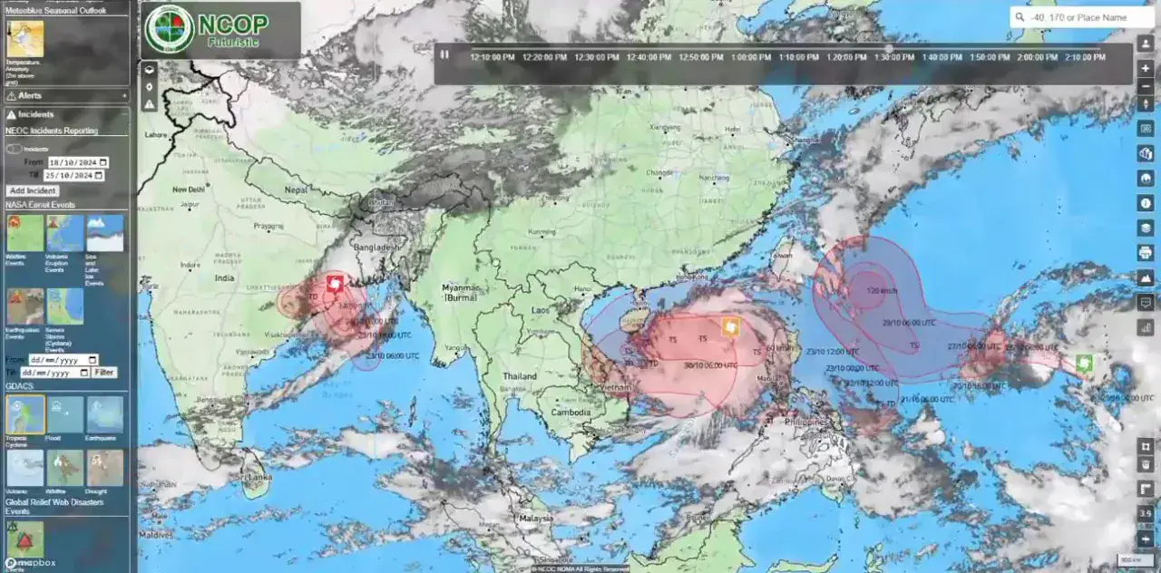
Added tropical storm tracking and satellite cloud imagery to the platform.
Tropical cyclone track and forecast-cone visualisation
Satellite cloud imagery overlaid on the operations map
Wind-swath and intensity bands rendered as graduated colour surfaces
Event pop-ups with storm category, position and advisory detail
Meteorological Release
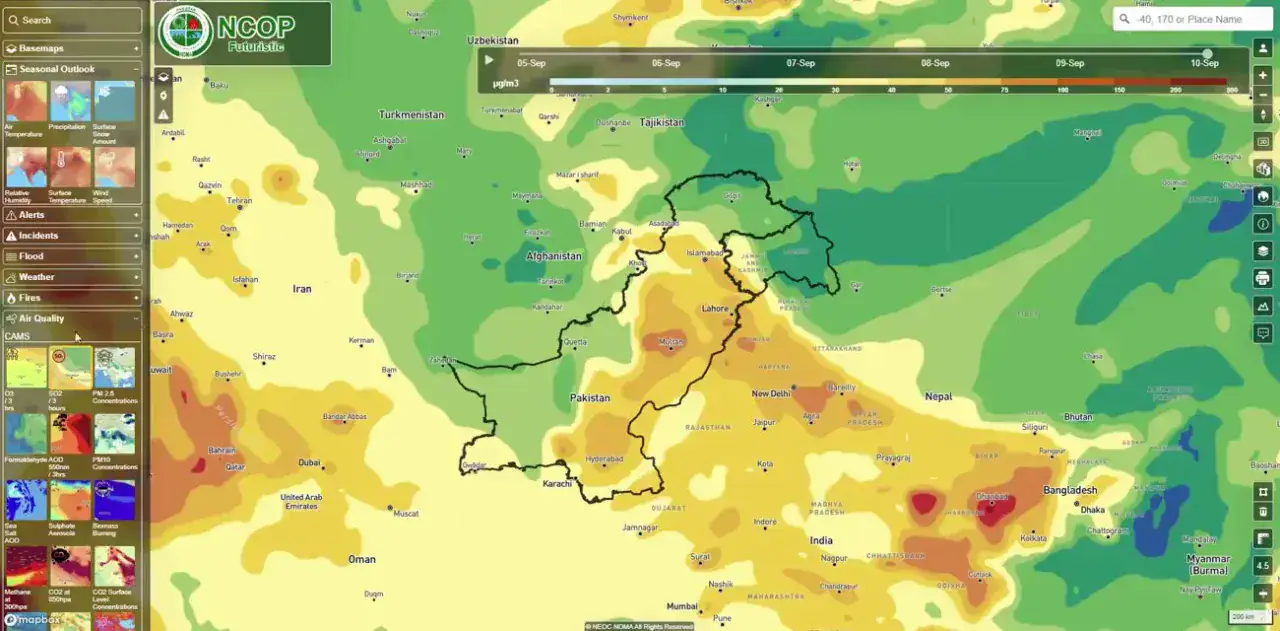
Introduced a full raster catalogue of climate and hydrological indicators.
Temperature, precipitation and soil-moisture rasters as styled surfaces
Rainfall accumulation products used for flood anticipation
Shared colour-ramp legend applied consistently across every product
Thumbnail catalogue letting operators switch products in one click
Global Integration Release
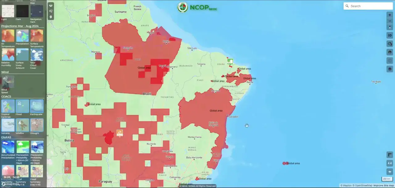
Wired the platform into international hazard feeds and event reporting.
Worldwide hazard coverage driven by a global alert feed
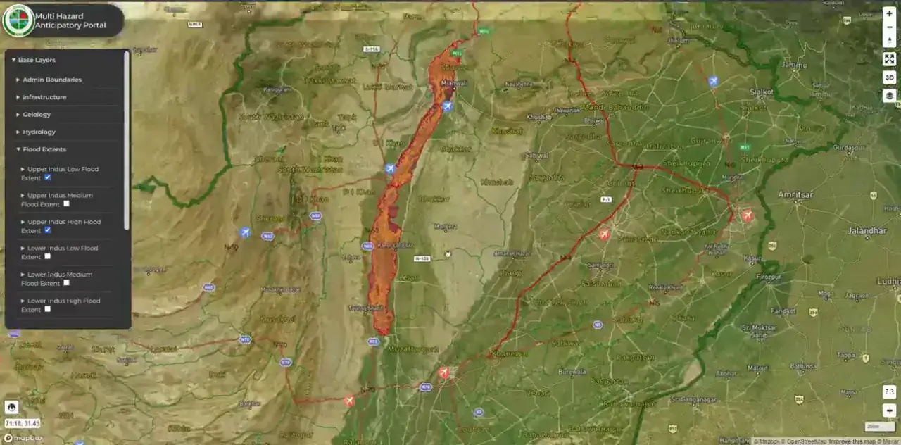
Flood-extent polygons published for affected administrative units
Earthquake shake-intensity rings from a live seismic API
Linked event summary pages with alert scoring and impact estimates
Foundational Release
Established the base map, layer catalogue and hazard overlays.
Satellite and terrain base mapping across the full national extent
Seismic fault lines, elevation and 3D terrain visualisation
Flood-extent and inundation overlays for affected river reaches
Population and exposure layers for impact assessment
Product
From The Working Application
Portfolio
Explore More GIS Projects
Contact Us
Have A Project?
Let’s Build ItHave a project in mind? Tell us what you're building and we'll get back to you within 12–24 hours with a clear plan.
🔒
100% Confidential
⚡
12–24 Hr Response
🛡️
60-Day Bug Fix
✅
Free Consultation
💬
Start Your Project
Fill in the details below or book a call