
GIS Case Study
Hyper-Local Weather Companion App — Mobile App
A hyper-local consumer weather app backed by a 300+ ground station network, 100K+ downloads on Google Play.
Domain
Consumer Weather / Mobile Application
Role
Mobile Application Developer
At A Glance
What Makes It Work
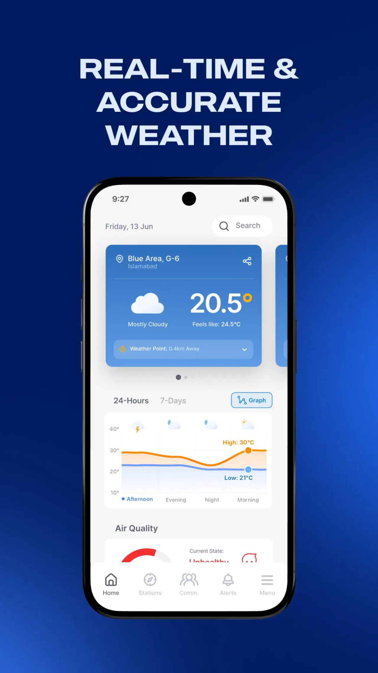
Live nowcast from the nearest ground station: temperature, rain, wind, humidity, pressure
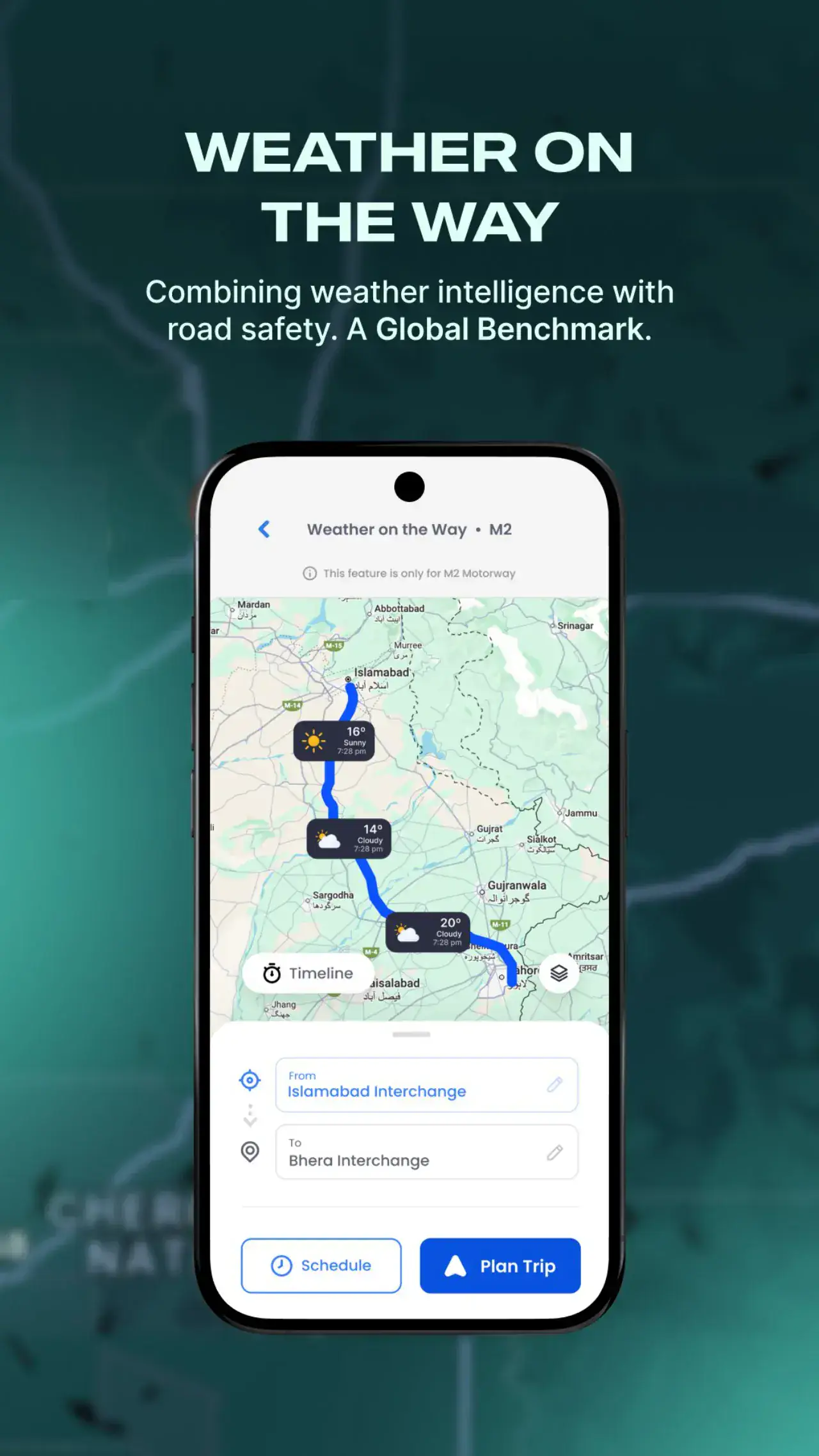
Motorway Journey Planner giving route-based weather for motorway trips
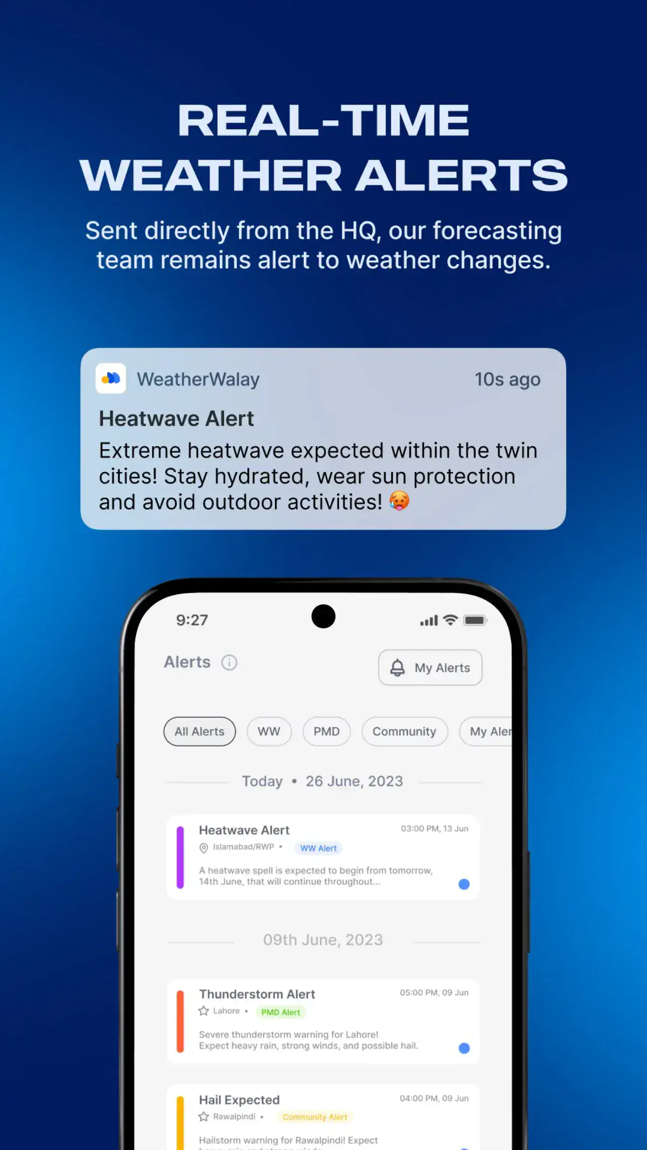
Hyper-local alerts for rain, storms, heatwaves and fog, plus user-defined MyAlerts
GIS station explorer with list, advanced and interactive WeatherViz map modes
Weather from the station down the road
Consumer weather apps in the region were running on global model data with a resolution measured in kilometres, which is fine for a general forecast and useless for the question people actually ask. Is it raining at my house right now. The operator of a 300-plus ground station network had the answer to that question and no consumer product to deliver it. The app was built to put the nearest station's live observations in a user's hand: a hyper-local nowcast, forecasts from local models, alerts for the conditions that matter in the region, and a station explorer for people who want to see the data behind the number. It has since passed 100,000 downloads on Google Play.
Nowcast, planner, alerts and the network behind them
The app is React Native with Mapbox and a Django back end shared with the station network. The home screen shows a live nowcast from the nearest ground station, temperature, humidity, rain, wind, plus 7-day and 24-day forecasts from local models. The Motorway Journey Planner, built on the same corridor logic as the operator's motorway portal, gives route-based nowcast, forecast and alerts for a planned drive. Hyper-local alerts cover rain, storms, heatwaves and fog, with platform alerts, expert-issued and automated, alongside. An Air Quality Index with health-based guidance follows the regional standard. Favourite locations, community weather reports from other users, and a GIS station explorer with list, advanced and interactive views round it out. The station explorer is the feature that turns a weather app into a transparent one: a user can see which station their reading came from and how far away it is.
A hundred thousand people checking the local station
Users get a nowcast that reflects the weather outside their window rather than a model cell, and motorists get route weather before they leave. Download growth has been organic, driven largely by the accuracy of the local reading during monsoon season and by the alerts. The product decision that mattered was transparency. Showing the source station made users trust the number, and trust is what a weather app is actually selling. The same back end serves the operator's public portal and motorway system, which is the consumer-facing end of a data platform we have built out across several mobile app development and web engagements for the same network.
Capabilities
Core Functionality
Live nowcast plus 7-day and 24-day forecasts from locally calibrated models
Motorway Journey Planner with route nowcast, forecast and trip scheduling
Air Quality Index with health-based guidance (Pak AQI and US AQI)
Platform Alerts, expert-issued and automated, alongside custom MyAlerts
Favourite locations and community weather reports from nearby users
Weekly expert weather videos covering provincial and national trends
Historic records for temperature, rainfall, wind and humidity
In-app shop for weather stations, sensors and data services
Full Urdu language support
Technologies
Tools & Stack
Product
From The Working Application
Questions
Frequently Asked Questions
Where does the nowcast come from?
From the nearest of more than 300 ground stations in the operator's network, not from a global model. The app shows which station is providing the reading and how far away it is, so users can judge the reading for themselves.
What is the Motorway Journey Planner?
A route-based weather tool: enter a motorway journey and the app shows nowcast, forecast and alerts along the corridor for the time of travel. It is built on the same corridor logic as the operator's motorway operations portal.
Which alerts does the app send?
Hyper-local alerts for rain, storms, heatwaves and fog based on nearby station readings, plus platform alerts that are either expert-issued by the operator's forecasters or automated from thresholds. Users control which alert types they receive and for which favourite locations.
Is the app available on iOS as well as Android?
It is built in React Native from a single codebase. The 100,000-plus download figure is Google Play; distribution on the App Store follows the same build.
Contact Us
Have A Project?
Let’s Build ItHave a project in mind? Tell us what you're building and we'll get back to you within 12–24 hours with a clear plan.
🔒
100% Confidential
⚡
12–24 Hr Response
🛡️
60-Day Bug Fix
✅
Free Consultation
💬
Start Your Project
Fill in the details below or book a call